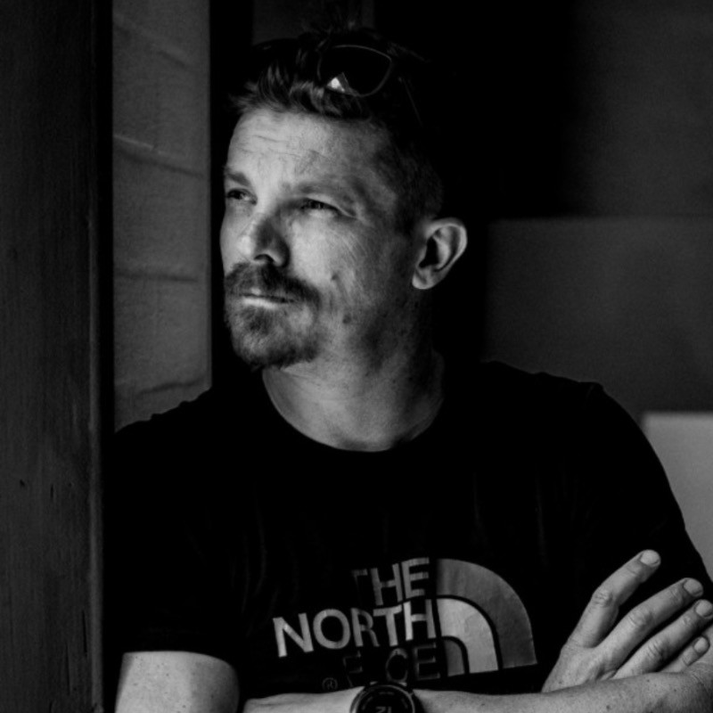
Overview
Niko Caignie is a certified drone pilot and the owner of AirScout-BE, based in Antwerp, a role he took up in October 2025. In September 2025 he founded Drone-Check EU. His stated areas of expertise are drone piloting, drone mapping, drone videography and drone photography. Since January 2008 he has worked as an allround photo and video professional at WorkHardPlayHard.
Earlier in his career he was a digital producer at VVL BBDO from February 2009 to November 2010, and a technical project manager at Duval Guillaume between January 2008 and February 2009. He spent several years with Scarlet, working in provisioning from September 2003, as a product manager at Scarlet Nederland from November 2005, and as a project manager at Scarlet Belgium from September 2006 to January 2008. Before that he was a team leader at Planet Internet from 1999 to 2003 and worked in internal sales at FlashComm from 1998 to 1999.
Caignie studied marketing at AP Hogeschool Antwerpen and at Karel de Grote-Hogeschool, holds a bachelor's degree in marketing from Birm, and followed an Arabic course at Crescendo CVO in 2024 and 2025.
Career history
- AirScout-BECurrent
Insights & ideas
The through-line
Across everything, Niko Caignie returns to one idea: the value is not in the flying or the footage, it is in what the client can actually do with the result. Briefs get reframed on arrival, from "make some 360° images" into "make sure someone who has never been here really gets to know the place" [3], and from a pretty picture into "een accurate meetbasis" [1]. Where the existing tools do not deliver that, he builds his own and says so plainly: "Lang gezocht, niet gevonden, zelf gemaakt. That's how we roll!" [7]
The second strand is a long apprenticeship in ways of looking. He has documented places through photo, video, drone and even analogue film, "en elke mogelijke combinatie", over twenty years in which the passion became a job and then became passion again [5]. That accumulated range is what lets him judge which method a job actually needs, and also what lets him strip things back when the equipment starts getting in the way [15].
On briefs that ask for measurement, not pretty pictures
The sharpest brief he cites is the one that refuses aesthetics as the deliverable. Seven in the morning on the Grote Markt in Mechelen, delivery trucks double-parked and the terraces still stacked, and the requirement was explicit: not a nice image but an accurate basis for measurement, with heights, depths, the position of every window frame and the recess of every bay [1]. The same instinct shows up at Tour & Taxis, tens of hectares of historic goods terminal ringed by an entirely new residential district, where the assignment was reframed from producing 360° images into producing familiarity for someone who has never set foot there [3]. In both cases the technical output is judged against a use, not against how it looks.
On building your own tools
Tool-building is treated as ordinary practice rather than a side project. The 360° tool exists because off-the-shelf 360° capture brought problems with it [5], and the general principle is stated without ceremony: searched long, did not find it, made it himself [7]. Drone-Check gets the same treatment, with a new version described as a lot of work under the bonnet plus visible changes on the site itself, all in preparation for a V3 with further features [4]. Crucially, the stated purpose of those features is not capability for its own sake but improving understanding of and visibility around drones [4].
On making heavy technical data usable
He names this as the hard part of the work: "Een grote uitdaging ligt bij het bruikbaar maken van alle technische en zware data voor klanten" [7]. It is the connective tissue between the measurement briefs and the tool-building. Photogrammetry, thermography and centimetre-accurate positioning are listed among the real content of the job [11], but they only count once the output reaches a client in a form they can act on, which is why the 3D model, the tour and the viewer are published alongside the work rather than described [1][3].
On "experience it like me"
The gap that pushed him toward 360° was emotional rather than technical. Every tool he had used could render a place beautifully and idiosyncratically, but he kept missing the "Experience it like me - gevoel", the sense of really standing there, looking around and experiencing it [5]. He anticipates the obvious objection, that you should simply pick up a 360° camera and capture it that way, and answers that this brought its own problems [5]. The habit persists opportunistically: on a drone assignment in Brussels he took the chance to make a 360° image from the air, and reports the perspective as surprisingly green [8].
On what a drone job actually consists of
He is blunt about the public misreading of the trade. People hear "drone inspection" and imagine you fly around a bit, take some photos and that is it, which he puts at "maybe 10 percent of the work" [11]. The rest is EASA regulations, centimetre-accurate positioning, operational manuals, thermography, photogrammetry, building tools and automating processes [11]. He then names the part he considers hardest, and it is not technical at all: "proving yourself all over again in a market where nobody knows you" [11]. The same corrective runs through his commentary on solar panels, where the point is that the panels are reliable, hardworking and quiet, perhaps a little too quiet, and what they do not tell you costs more than you think [12].
On keeping production simple
The nature podcast is built on subtraction. Conversations happen while walking outdoors rather than in a controlled studio, and production is deliberately kept simple, concentrated on good audio with minimal video [15]. Multiple cameras and extra equipment were abandoned once it became clear they were interfering with genuine conversation [15]. It is the same judgement as elsewhere, applied in reverse: for an accurate measurement basis you add rigour, and for a real conversation you remove kit.
On the field, and what goes wrong in it
Field problems get diagnosed rather than endured. A run of bird attacks on his drones, the same alarming call each time followed by two or three birds making unhesitating dives with potentially disastrous consequences, forced him to break off an assignment mid-harbour [9]. His response was to identify the species with the Merlin app and then look for a bird-friendly solution [9]. The habit of documenting sites in their working state, imposing shipyards in the port of Ghent, a market square before the terraces go out, is part of the same disposition toward what is actually there [1][6].
On staying visible in the sector
Publishing is treated as a working obligation, not promotion. A newsletter carries relevant news and work from the sector into people's inboxes, framed with a joke about not delivering the post by drone [10], and each edition is pushed out again afterwards with a link to subscribe so the next one is not missed [2]. It sits alongside Drone-Check's stated goal of improving understanding and visibility of drones [4] and the career-switch writing aimed at other professionals making the same move [11].
Takeaways
- Reframe the brief before you fly: the useful version of "make some 360° images" is "make sure someone who has never been here really gets to know the place" [3], and the useful version of a nice picture is "een accurate meetbasis" with heights, depths and the position of every window frame [1].
- When the tool you need does not exist, build it: "Lang gezocht, niet gevonden, zelf gemaakt" [7].
- The delivery problem is the real problem, making all the technical and heavy data usable for clients [7].
- Flying is roughly 10 percent of drone inspection work; the rest is EASA regulations, centimetre-accurate positioning, operational manuals, thermography, photogrammetry, tool-building and automation [11].
- The hardest part of a career switch is not technical, it is "proving yourself all over again in a market where nobody knows you" [11].
- Strip production back when the gear starts costing you the content: multiple cameras were dropped from the walking podcast because they interfered with genuine conversation [15].
- Diagnose field obstacles instead of working around them blindly: identify the attacking birds, then find a bird-friendly solution [9].
Media & appearances
- Niko CaignieYouTubePodcasten in de natuur, keep it simple!Niko Caignie discusses his approach to creating a nature-based podcast where he conducts conversations while walking outdoors rather than in a controlled studio environment. He explains that he deliberately keeps production simple, focusing primarily on quality audio recording and minimal video content, having abandoned the use of multiple cameras and equipment after realizing they interfered with genuine conversation.
- Niko CaignieYouTubeRoeland
- Niko CaignieYouTubeSerge
In the news
- Me vs the smartphone: A (long-running) search for ownership over my own time and attention. https://lnkd.in/dcwwSUFR
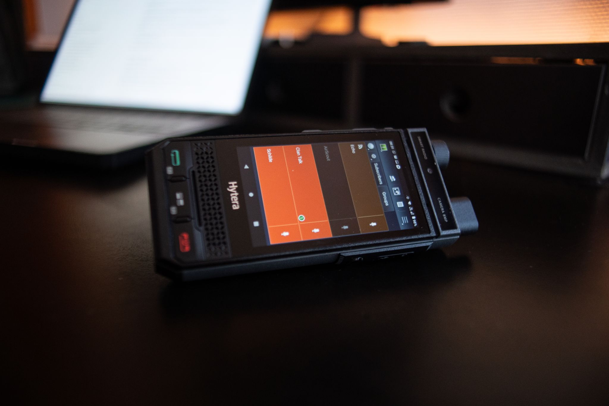
- Wat is uw probleem eigenlijk? Nee, echt. Ik meen het letterlijk. Ik vlieg niet met drones om alleen data te verzamelen. Ik los problemen op en een drone is meestal het efficiëntste gereedschap dat ik daarvoor heb. Data verzamelen is het begin, niet het product. Ik lever een antwoord: van probleemstelling tot resultaat in je mailbox, of rechtstreeks in je proces. Wat me interesseert zijn de dingen die vandaag moeilijk op te lossen zijn. Te groot, te hoog, te traag, te gevaarlijk. Of simpelweg: er bestaat nog geen methode voor, maar
- One year. A new sector, roughly forty unfamiliar fields of expertise, and seven days a week to get through them. What AI made possible and cannot do. And what the year actually cost.
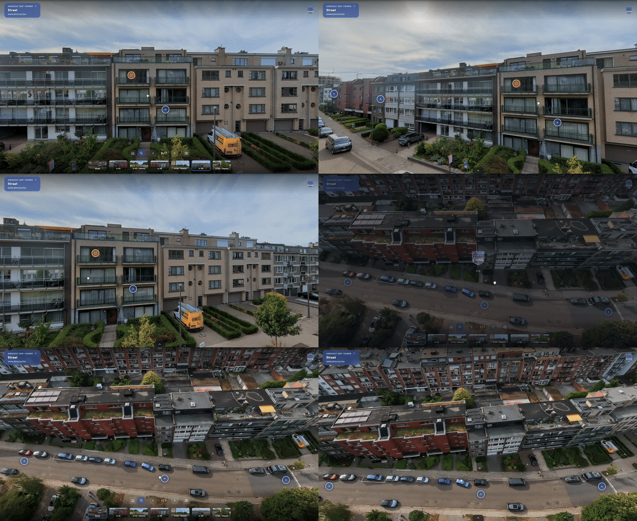
- Verhuizen is meer dan dozen dragen. VZW De Vijver begeleidt onder andere mensen met een verstandelijke beperking bij de stap naar zelfstandig of begeleid wonen. Die stap is groot. Nieuwe geluiden, een andere route naar de winkel, een andere voordeur. Net wie het meest baat heeft bij voorbereiding, kan zich vaak het moeilijkst voorbereiden. Dus bracht ik de locatie naar de bewoner in plaats van omgekeerd. Ik fotografeerde het volledige project in 360°. Buiten met de drone: de straat, de buurt en het gebouw in context. Binnen
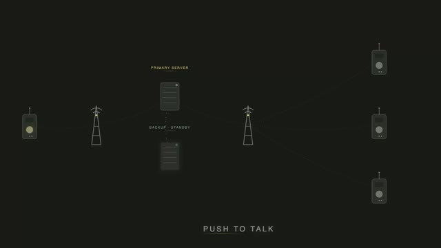
- Klein technisch zij-projectje. Op basis van mijn POC netwerk een noodknop voor IOS & Android gemaakt. Because I can. https://lnkd.in/eUedYRcZ
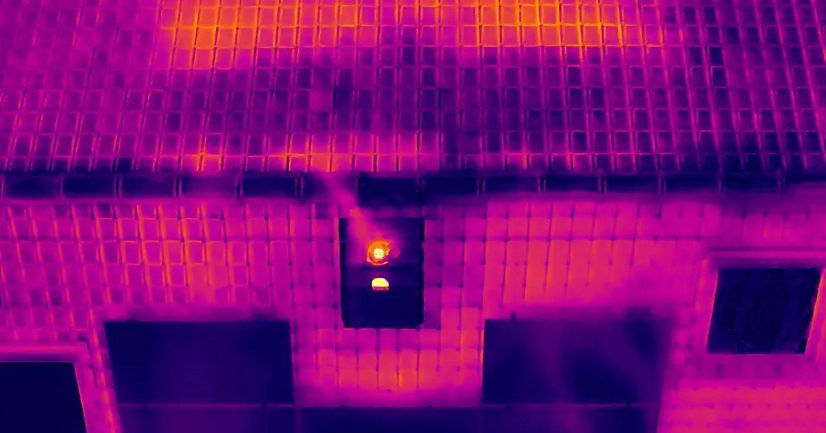
- September, dat is nog steeds mooi warm weer overdag en lekkere koele nachten. Frissere nachten maken warmteverlies zichtbaar. Een thermische camera meet het verschil. Pas als de verwarming aan gaat en de nachten afkoelen, wordt zichtbaar waar de warmte uw gebouw verlaat. Dat venster loopt van eind september tot maart. Wat een scan dan precies toont en waarom een visuele dakinspectie in dezelfde vlucht past leest u hier: https://lnkd.in/dA5mRGhb
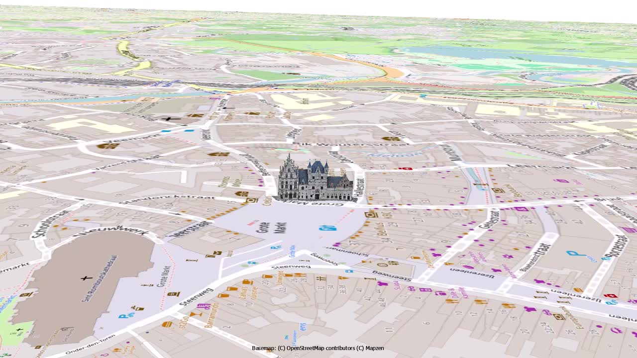
- Grote Markt Mechelen in 3D Zeven uur 's ochtends. De camions van de horecaleveringen staan dubbel geparkeerd, de terrassen liggen nog opgestapeld en op het mooiste plein van Mechelen staan wij met een drone naar boven te kijken. De vraag van de opdrachtgever was scherp: geen mooi plaatje, maar een accurate meetbasis. Hoogtes, dieptes, de plaats van elk raamkozijn, de terugsprong van elke erker. Het volledige verhaal, met het 3D-model: https://lnkd.in/ezibRWZ7
- De laatste newsletter is net de deur uit! Heb je 'm gemist, hieronder kan je hem nog bekijken. Wil je de volgende niet missen schrijf je dan hier in: https://lnkd.in/erX-Pkuc https://lnkd.in/eg49gYQ4
This page shows public professional information only, each fact cited. Is this you? send a correction, or ask for removal within 24 hours, no questions asked.