
Overview
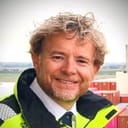
It was founded in 2022 and lists a company size of 2 to 10 employees. The company sells a real-time community solution that uses mapping and navigation technology to make river navigation safe and to maximise the load capacity of cargo ships. Its stated mission is to develop rivers as vibrant, ecological and cost-effective corridors for cargo transportation, through crowd-based river charting and dynamic navigation routing. The product line has three parts. BathyBox scans and analyses riverbed characteristics from small vessels such as canoes, ferries and fishing boats. NaviRiver runs on tablets, iPads and smartphones and optimises navigation routes on board. RiverMapper sits in the cloud and derives insights into river terrain and conditions using artificial intelligence and big data. The system leverages sensors already present on ships to record depth and GPS position data in real time and send it to the cloud for analysis. Readings shared by the community of ships carrying the system are combined into navigation maps that update continuously as vessels move. The company states the technology can be deployed in days and produces navigation data from the start. Kris Decker, listed as Kris De Decker, appears among the company's employees and was named as the contact person on the website.
Stated facts & numbers
- Founded: 2022
- Headquarters: Stabroek, province of Antwerp
- Employees: 2-10
- Industry: Maritime transportation
- Company type: Privately held
- Products: BathyBox, NaviRiver, RiverMapper
- Services: River data processing, depth sounding, consultancy
- Contact: info@optiriver.com
- Website languages: English, French, Spanish, Portuguese
- Key person: Kris De Decker
Leadership & org chart
In the news
- Un tema clave, Ernesto S. ⚓ La sedimentación puede cambiar la profundidad disponible entre levantamientos hidrográficos, por lo que contar con datos actualizados es fundamental para evaluar el margen bajo la quilla. En OptiRiver aprovechamos las mediciones de profundidad de las embarcaciones en navegación para actualizar la información del fondo en tiempo real e identificar cambios. Así aportamos datos para apoyar la gestión dinámica del UKC y las decisiones de prácticos y autoridades portuarias. 🌊📊 ¡Excelente iniciativa de
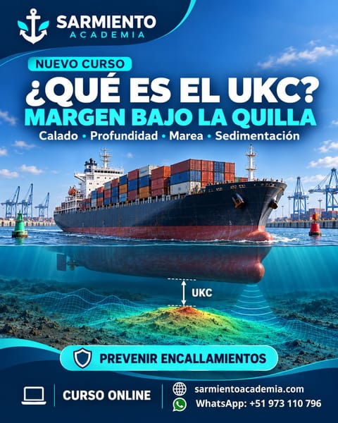
- https://lnkd.in/dA_X3uf5 ⚓ Nuevo curso: ¿Qué es el UKC? Margen bajo la quilla ¿Sabes qué distancia de seguridad debe mantenerse entre la quilla del buque y el fondo marino? En este curso de Sarmiento Academia aprenderás a: ✅ Comprender el concepto de UKC (Under Keel Clearance). ✅ Relacionar el calado, la profundidad, la marea y la sedimentación. ✅ Identificar los factores que reducen el margen de seguridad. ✅ Prevenir encallamientos durante maniobras portuarias y la navegación en aguas poco profundas. Dirigido a personal marítimo
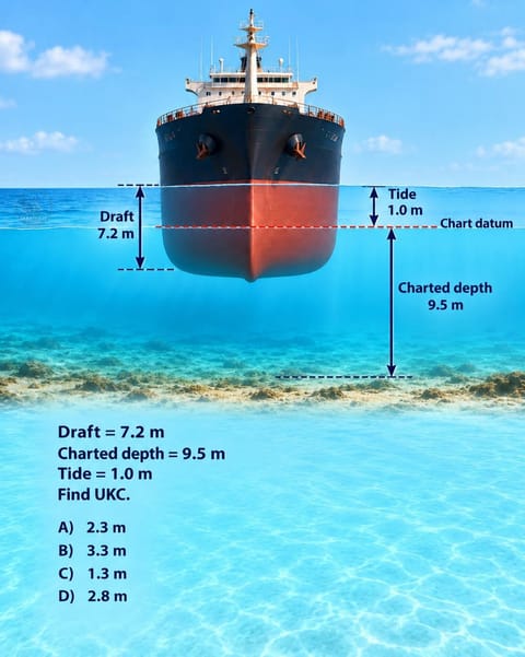
- J.M. LEMOS 🌊An essential calculation—but how current is the charted depth beneath your vessel? Sedimentation and storms can change the seabed, affecting the clearance available. 🚢 At OptiRiver , we turn depth measurements from vessels into updated depth intelligence, supporting dynamic under-keel clearance and better-informed navigation decisions. 📡 #OptiRiver #UnderKeelClearance #MaritimeSafety #SmartPorts #DigitalTwin
- The fastest growing continent on the planet. The need for sustainable high capacity corridors is high, water infrastructure is limited. One way forward: OptiRiver Enabling safe and swift cargo transport over navigable rivers.
- Safe navigation begins with understanding the water under your vessel. Test your knowledge of under-keel clearance (UKC) with this practical question.
- Hydro2026 has broken the ice. All things hydro came up for discussion: ▶️ S100 ▶️ Capacity building ▶️ Historical charts ▶️ GPS jamming ▶️ International exchange ▶️ OptiRiver demo It's going to be a great conference. #stormkop
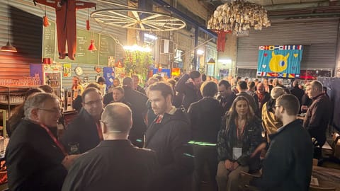
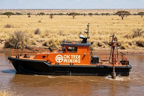
- Karlsy Tasion Absolutely— keeping the river navigable is essential to keeping the economy moving. 🚢🌊 At OptiRiver , we turn depth measurements from operating vessels into information that helps identify shoaling, support dredging priorities and inform underkeel clearance assessments. 📊 For rivers like the Fly, combining regular surveys with observations from everyday vessel movements could help operators spot changes earlier and respond more effectively. Collaboration between pilots, ports, surveyors and dredging teams is
- It was after my post about the hydrographic and sounding in fly river that triggered enormous attention and response... Elnino is a long term terminator..the recovery is slow and the damaged is stretched indefinite..better not be waiting when to react.. "the River must flow..the ships must move and the economy keeps going" It would be great to see that a serious dredging station will have to be born in the mid Fly River so soon.. Now your talking 🥂🇵🇬👌🏿 ktasion360@gmail.com

Alumni 1 went on to found or lead
 Phil ClerxProduct Developer→Co-Founder at Darwin Design
Something wrong or missing? Send an update. Fixed within 24 hours.